UF Animal Forensics Conference 2024 - Geographic Information Systems with Jessica Pfohl and Anne Washington
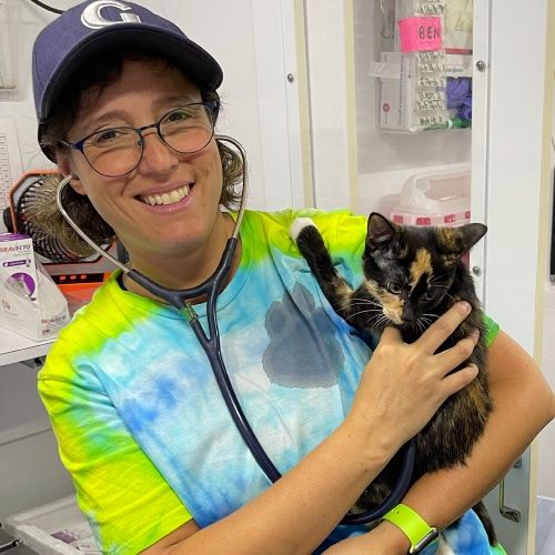
We are in person at the 2024 Animal Forensic Conference in Gainesville, Florida! Dr. G will be interviewing several of the speakers to give our audience a bit of the knowledge gained through the presentations. We will be releasing each interview individually to allow our listeners to find topics of interest.
Geographic Information Systems is the use of technology to identify crime hotspots through the use of spatial data. This is very useful in the prevention of wildlife crimes and poaching. Experts Jessica Pfohl and Anne Washington from the Florida Fish and Wildlife Commission, share their knowledge and how others can obtain information and resources to implement this technology in their areas.
We would also like to invite our listeners involved in animal cruelty investigations to visit and join the International Society for Animal Forensic Sciences https://isafs.org/
Mentioned in this episode:
Keep it Humane Podcast Network
The Animal Welfare Junction is part of the Keep It Humane Podcast Network. Visit keepithumane.com/podcastnetwork to find us and our amazing animal welfare podcast partners.
Transcript
Our next guests are Jessica Pfohl and Anne Washington from the Florida Fish
2
:and Wildlife Conservation Commission.
3
:Thank you so much for being here
and welcome to The Junction.
4
:Thank you.
5
:Anne Washington: Thank you.
6
:DrG: Can you introduce yourselves and
what your background is and how it relates
7
:to the field of veterinary forensics?
8
:Jessica Pfohl: Uh, so I'm Jessica Pfohl
and I have a bachelor's degree in criminal
9
:justice and a master's in administration
of justice, um, and I was an analyst for
10
:probably about 10 years before I came
to Florida Fish and Wildlife where I am
11
:the, um, intel analyst, uh, supervisor.
12
:Anne Washington: And my
name is Anne Washington.
13
:I have a degree, , in conservation biology
for my bachelor's and biodiversity and
14
:conservation biology for my master's.
15
:And, my projects were in GIS
and doing, spatial data analysis.
16
:So that kind of transferred over into
FWC, where I am now the GIS technician
17
:for their law enforcement department.
18
:DrG: What is the purpose of the FWC?
19
:Jessica Pfohl: So, Florida Fish
and Wildlife, um, it was created to
20
:protect him and preserve florida.
21
:Um, it's natural, um, habitats,
waterways, um, and protect its animals.
22
:Um, and we do a lot of enforcement
on obviously fishing, captive
23
:wildlife, boating, things like that.
24
:DrG: Your talk was on geographic
information systems, and that
25
:is something that is very,
can I say, very technological.
26
:What is GIS?
27
:Anne Washington: So, GIS is geographic
information systems, which is
28
:basically any sort of program or data
analysis that looks at spatial data.
29
:So, Crime is a spatial problem.
30
:It happens at a place at a time.
31
:So to be able to identify trends or to
be able to identify hot spots, you want
32
:to be able to map out this data and
then run statistical analyses on it to
33
:be able to better identify those areas.
34
:DrG: How does GIS help with
animal cruelty investigations?
35
:Jessica Pfohl: So we basically use
GIS to try to do more hotspots.
36
:Um, it's not really used in like,
per se, like animal cruelty.
37
:Um, but when officers want to
know where they should set up a
38
:deployment, because they're trying
to stop, you know, poaching.
39
:Good example is night hunting.
40
:Um, so you're not supposed to
do that, but that's when a lot
41
:of times guys go out to poach.
42
:So, um, we do hot spot maps to show them
in their area of responsibility where
43
:they should be setting up for deployment.
44
:Obviously, you don't want your
officer spending time deploying to
45
:a place over the last five years.
46
:It's never had.
47
:an incident or a call for service
or a warning or a citation written.
48
:You want them to go to places where
that has, has typically happened.
49
:And that's why we do the hotspots to
show them that this is where you need
50
:to go so that we can try to stop the
poaching of, you know, Florida's wildlife.
51
:DrG: What kind of data do you
use to, to get this information?
52
:Jessica Pfohl: So we use, not only, we
use calls for service, um, we use, um,
53
:We use citations and we use warnings.
54
:I don't, some, we could use field
intel reports, but they don't
55
:really, they're more for intelligence
gathering, but that's the data
56
:points that we're showing them.
57
:This is where all the resource
citations, resource warnings, and this
58
:is where it's your calls for service.
59
:And we do both, we do a map of calls for
service, we do a map of, of warnings and,
60
:um, citations, and then they can, then we
too do them together so you can kind of
61
:see whether they're correlating or not.
62
:DrG: So, once you collect the data and
you kind of know where the problem is
63
:happening, what's the next step and what
kind of technology can you use to, to
64
:find the perpetrators of these crimes?
65
:Jessica Pfohl: So, the officers will
then go out and do their deployments,
66
:um, and then we can also set up, you
know, game cams and things like that
67
:so we can see if there's traffic
coming in and out of that area.
68
:We can then use, like,
license plate reader systems.
69
:Um, facial recognition to
try to identify those people.
70
:People per se we get a picture of somebody
off a trail cam or something like that.
71
:Then, you know, we can use facial rec
or we can check the cameras to see who
72
:may have been coming in and out, um,
and then look at, look at the vehicles
73
:and, and tags and things like that.
74
:DrG: You were talking about using both
GIS data and then ecological data.
75
:So how do you use both of
them in, in what you're doing?
76
:Yeah.
77
:Anne Washington: So ecological data kind
of helps us focus in on areas of activity.
78
:So like for instance, you know,
you're interested in turtles or our
79
:freshwater turtles, which are being
poached and sold overseas as a delicacy.
80
:Uh, you're probably not going
to be finding them in areas
81
:where that turtle isn't present.
82
:So we kind of use that ecological
data to be like, okay, this is
83
:where the turtles are occurring.
84
:So if we have high populations
of them, that's most likely where
85
:they're going to get poached.
86
:And then we can then overlay that
with our hotspot analysis to actually
87
:see if that's actually the case.
88
:And if not, then we have to figure
out, okay, is there a gap in our data?
89
:What are we missing here?
90
:And then we can, uh, further continue
our, um, you know, deployments and
91
:rechecking that data to make sure
that we are focusing on those areas
92
:which are being um, used up basically.
93
:DrG: This is a really interesting
and great use of technology, and
94
:I imagine that there's not a lot
of places that are doing this.
95
:So if there are some of the listeners
that are interested in finding more
96
:information, what resources are there?
97
:Jessica Pfohl: Well, they
can contact one of us.
98
:Um, we've helped multiple, uh, wildlife
agents across the, uh, country with
99
:not only intelligence, but, uh, G.
100
:I.
101
:S.
102
:I know has been in touch with
several of the agencies as well.
103
:So anytime they need anything, it's
kind of hard to find training and
104
:things like that specific to wildlife
crime for intelligence analysts and G.
105
:I.
106
:S.
107
:Um, so we kind of all just
kind of help each other.
108
:So they'll, they'll, uh, They can
reach out to either Anne or I.
109
:DrG: Fantastic.
110
:Well, thank you so much for sharing
your knowledge with this, and
111
:thank you for what you're doing.
112
:Jessica Pfohl: Thank you.
113
:You're welcome.
114
:Thanks for having us.

